Agalyk mountain range
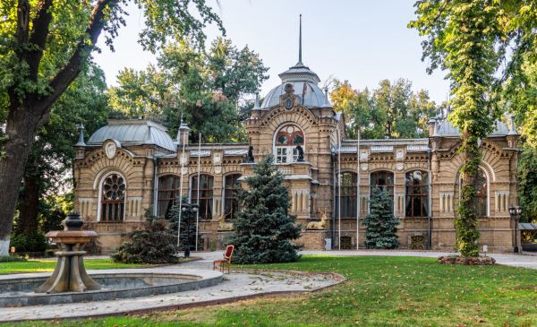
The Uzbek city of Samarkand is presented to tourists as an oriental fairy—tale city - a city of mosques, madrassas and minarets. This is true, but few people know that Samarkand is surrounded by mountains and as soon as you leave the city, absolutely incredible vivid landscapes appear before the eyes of surprised tourists.
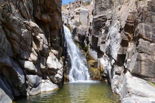
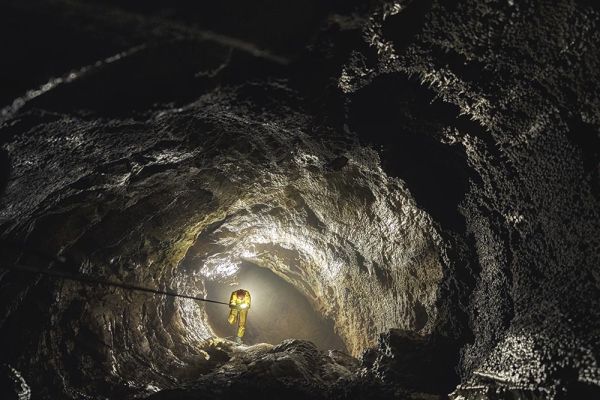
The Agalyk mountain range (also known as Okhalik) is an incredibly picturesque natural landmark located in the Samarkand region, 15 km southwest of Samarkand, in the valley of the Agalyksai River. Agalyk is a spur of the Zeravshan range, which stretches for 370 km in the territories of Uzbekistan and Tajikistan.
Relief
The relief of the Samarkand region is mainly represented by hills and low mountains located in the southern and eastern parts of the region. There are also lowlands. The mountainous areas of the region are on average located at an altitude of 700 to 900 meters above sea level. The average height of the area is about 450 meters. In addition to Agalyk, the Mirankul and Sarykul mountain ranges are located in the region.
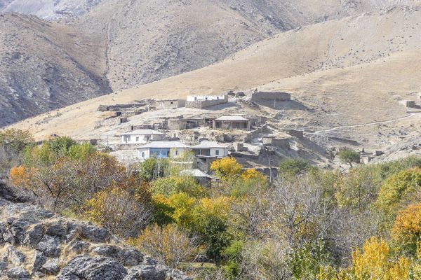
Agalyk, located in the area of the village of the same name, has an average altitude of about 818 meters above sea level. The main peak of Agalyk and the entire Samarkand region is Mount Kemkutan (2,178 m).
Climate
The climate of the territory is subtropical, with hot summers and fairly cool winters. The average annual temperature is +13 degrees, the average temperature in January is about 0 degrees, and the average temperature in July is about +25 degrees. In general, summers in the region are long, hot and arid — 300-320 mm of precipitation per year falls in the region. Most of the precipitation falls in spring and autumn, and snow often falls in winter. The number of clear, sunny days significantly exceeds the number of cloudy ones.
The most favorable time to visit this region is the beginning and middle of spring — during this period, flowering begins on the mountain slopes, and there is still no hint of the approaching summer heat in the air.
Flora and fauna
The flora of the Agalyk massif is quite rich. First of all, crops of forage value are widespread here: camel thorn, wormwood, wheatgrass, panicle. In the wild, there are apple trees, wild rose, barberry, various types of walnut trees, and many types of medicinal mountain herbs.
In spring, during the flowering period, a special picturesque "attraction" for tourists is the poppy blossom. The huge poppy fields of this region are striking in their size and beauty.
The wildlife cannot be called extensive due to the climatic conditions and landscape. Nevertheless, there are hares, wolves, and various small rodents in the mountainous area. Snakes are common, as well as steppe and predatory birds: hawks, peregrine falcons, kites.
What is interesting about Agalyk
Located at an altitude of more than 800 meters above sea level, the Agalyk region is distinguished by an abundance of sun, dry and clean healing mountain air, favorable for the treatment of patients with respiratory diseases. Several sanatoriums have been opened here: the children's tuberculosis sanatorium and the Agalyk sanatorium, which also offers specialized courses for the treatment of diseases of the nervous system, cardiovascular system, digestive tract and other wellness procedures.
The Agalyk mountain range is extremely popular as a destination for hiking, one-day and multi-day hikes. Due to the fact that the mountains here cannot be called high, climbing them is accessible even for beginners. Tours are organized for professionals to conquer more difficult peaks, for example, the Kemkutan Mountains.
How to get
The Agalyk mountain range is located in the Samarkand region, at a distance of about 15 km from the center of Samarkand. The village of Agalyk and Samarkand are connected by bus service.
But for sightseeing in Agalyk, it will be more convenient to use taxi services. So, after agreeing with the taxi driver in advance (and making sure to specify the final cost of the trip), you can take an individual tour to the Agalyk mountains.
GPS coordinates of the village of Agalyk for the navigator: 39.53611, 66.89472
The most popular taxi hailing services in Uzbekistan are iTaxi.uz or Taxi Ok. Most of the taxi service cars in the city are a bright yellow Daewoo Nexia brand.
The route from Samarkand to the village of Agalyk on the Google maps map.
It is difficult to plan a trip around the city by car, since there are no car rental points in Samarkand.
You can also get to the Agalyk Mountains as part of an organized tour from Samarkand. You can book such an excursion both online and through special travel agencies in the center of Samarkand.

Place on the map
Tours where you can visit this place:
Agalyk mountain range
Tashkent — Samarkand — Shakhrisabz — Bukhara — Tashkent
- 720$
- 7d.
Agalyk mountain range
Tashkent — Bukhara — Samarkand — Tashkent
- 640$
- 7d.
Agalyk mountain range
Khiva — Khorezm — Bukhara — Samarkand — Tashkent
- 730$
- 7d.
Agalyk mountain range
Bukhara — Surroundings of Bukhara — Samarkand — Tashkent
- 500$
- 5d.

Agalyk mountain range
Samarkand — Shakhrisabz — Bukhara — Surroundings of Bukhara
- 480$
- 5d.

Agalyk mountain range
Samarkand — Bukhara — Khiva
- 440$
- 5d.

Agalyk mountain range
Tashkent — Samarkand — Bukhara — Khiva
- 590$
- 6d.
Agalyk mountain range
Tashkent — Samarkand — Shakhrisabz — Bukhara — Surroundings of Bukhara
- 1150$
- 7d.